Online:Daggerfall Territory
|
||||
|---|---|---|---|---|
| Zone | ||||
| Cyrodiil | ||||
| Location | ||||
| Northwestern Cyrodiil | ||||
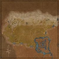
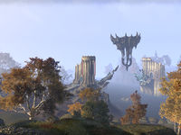
The Daggerfall Territory in Cyrodiil initially comprises the northwesternmost regions. The six keeps that make up the initial defenses of the Daggerfall Covenant are all located here. In addition, the city of Bruma is in the northeastern portion, and the towns of Chorrol and Weye can be found in the south. The Imperial City lies across Lake Rumare to the southeast, but is inaccessible. The Aldmeri Territory is separated by a mountain range to the south on the western side, through which there are three gated passes. The Ebonheart Territory lies across another mountain range to the east, also with three gated passes.Swimming across Lake Rumare is inadvisable, as it is rife with Slaughterfish. There are three Dolmens here; Applewatch Wood Dolmen and Winter's Reach Dolmen are found in the north, and the Northwestern Shore Dolmen is on the shore of Lake Rumare in the south.
Amber Woodland[edit]
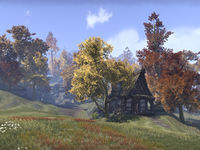
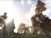
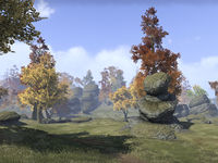
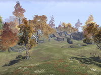
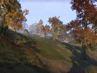
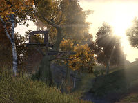
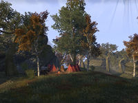
The Amber Woodland is located north of Fort Rayles. The region comprises rolling hills and rocky crags, as well as a high concentration of autumnal trees. A trail runs along the top of the western crag from Fort Rayles to Fort Warden. The ruins of Sancre Tor can be found in the southwest of this region, and Lipsand Tarn nestles in the western cliffs.
An inactive dolmen lies far south of Fort Warden Mine. There is a small bridge near Fort Rayles with a Frost Troll and a chest beneath it.
Anga Valley[edit]
Anga Valley lies to the northeast of Bleaker's Outpost, and runs from the Sercen Hills in the west to Winter's Reach in the east. A road runs along the valley connecting the outpost to Horunn Milegate. The Ayleid ruin of Anga from which the valley gets its name sits on the northern slopes. Wolves wander the valley.
Applewatch Wood[edit]
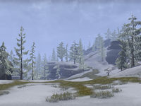
Applewatch Wood lies north of Fort Aleswell and west of Bruma. This largely wooded region sits on the snowline between the Heartlands and the Jerall Mountains and is dotted with rocky outcrops. Applewatch itself sits on the northern road between Bruma and the Warden Highlands. Two roads lead southwards towards the Orange Road above Fort Aleswell, which runs along the southern edge of the region. The Highlander Camp spans the western of these roads, and The Lover stone can be found just to the west of it. Applewatch Wood Dolmen is located between the camp and the Orange Road. Wolves prowl the hills.
Autumn Range[edit]
Autumn Range is situated between Fort Glademist and Fort Aleswell, and is a sparsely-wooded area of upland plains. The Orange Road from Chorrol to Bruma runs through the region, and the Ayleid ruins of Piukanda and Moranda can be found here. Underpall Cave sits in the northeast corner of the region.
Colovian Crags[edit]
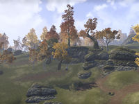
The Colovian Crags can be found in the southwest of the territory, south of Fort Rayles around the town of Chorrol. Littered with outcroppings and other rock formations, the region marks the edge of the Colovian Highlands. The Gate of Alma Ruma is located in the northwest of the area, from which roads run to Rayles, Chorrol, and beyond. Green Lake can be found in the south.
Echo Cliffs[edit]
Echo Cliffs is a region in the north of the territory found northeast of Fort Warden. As part of the foothills of the Jeralls, the region is dotted with rocky escarpments and spurs. A road runs west to east through the western part of the region from Fort Warden past Zimar's Winery and on towards Bruma, while a second road leads north from Applewatch into the eastern section. Echo Cave can be found in the south of the region on the border of the Warden Highlands.
Evergreen Crags[edit]
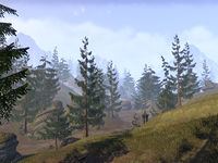
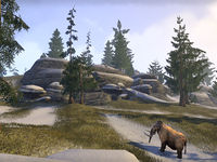
The Evergreen Crags are found to the east of Fort Dragonclaw. The northern part of the region is dominated by a large lake, while the southern crags are home to a number of mammoths. Beyond the crags, the region descends into Anga Valley, on the northern slopes of which sits Red Ruby Cave.
Evergreen Crags is home to Tundra Mammoth bulls and calves, Craghammer Giants, bears, tundra-dwelling archers and ravagers, wisps, ice wraiths and wispmothers.
Glademist Fields[edit]
Glademist Fields can be found southwest of Fort Glademist. The region is sparsely wooded and contains a number of ruined buildings. A medium-sized Imperial Camp can be found just off the Orange Road from Chorrol. In the west of the region, Hrotanda Vale and the Shadowed Path Tower look down over Fort Rayles. The Mage Mundus Stone can be found in the north, nestled in the cliffs that mark the southern end of the Amber Woodland.
Jerall Steps[edit]
The Jerall Steps are located to the west of Fort Dragonclaw. Mostly open but for a few trees and rock formations, the Steps are dominated by Cloud Ruler Temple which sits on a high plateau northwest of Bruma. Capstone Cave and the Ayleid ruin Rielle can be found in the south of the region.
Lonely Hills[edit]
The Lonely Hills are situated north of Fort Ash. Mostly open apart from a few clusters of trees, the region contains a number of ruins, from burnt-out farmhouses and ruined keeps, to old Imperial forts like Coldcorn and Ayleid settlements such as Lindai. A small lake can be found in the southwest of the region, and The Thief stone lies in the east.
Northern Shore[edit]
The Northern Shore of Lake Rumare runs from the border with the Ebonheart Territory in the east, past the ruins of Caractacus as far as the Northwestern Shore Dolmen.
Northwestern Shore[edit]
The Northwestern Shore of Lake Rumare runs from the eponymous dolmen at its eastern end, around to the village of Weye. The Red Ring Road cuts through the region on its way from Fort Ash in the south, through Empire Tower, and on towards Fort Aleswell in the north. A bridge to the Imperial City also leaves from the northwestern shore, but it is inaccessible due to the Daedric invasion.
Sercen Hills[edit]
Sercen Hills is the region surrounding the Ayleid ruin of Sercen to the east of Fort Aleswell. It is a moderately-wooded area with numerous trails and tracks running between its hills. The Imperial Bleaker's Outpost is located in the region, but it has been commandeered by the Alliances as part of the ongoing Alliance War. The nearby village of Bleaker's Way has become overrun with giants. The Red Ring Road runs through the region from Aleswell in the west to the Chalman Milegate on the Ebonheart Territory border in the east.
Twilight Woods[edit]
The Twilight Woods are a small wooded area north of Fort Glademist. Nestled in a secluded valley, the woods are also the location of the Ayleid ruin Ninendava.
Warden Highlands[edit]
The Warden Highlands are located to the southeast of Fort Warden. The region is dominated by a large lake, on the shores of which sits Ice-Heart Home. Mammoths make their home in the southern crags, and a pass leads from the lake south towards the Twilight Woods.
Western Shore[edit]
The Western Shore of Lake Rumare is the region around the village of Weye, and runs from there south to the Aldmeri Territory border. An entrance to the Imperial Sewers can be found in the trees behind the village.
Winter's Reach[edit]
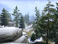
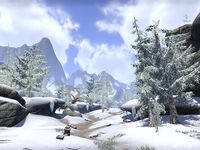
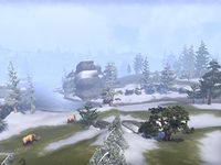
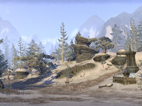
Winter's Reach is the northeasternmost region of the territory, and contains the Winter Gate into the Ebonheart Territory. The region is sparsely forested and contains numerous rocky outcrops which are home to mammoths. Winter's Reach Dolmen is located in the west, while a road leads down the eastern side from Winter Gate to Horunn Milegate.
Places[edit]
Major Settlements[edit]
 Bruma — A city in northern Cyrodiil, south of Fort Dragonclaw. (map)
 Chorrol — A town in northwestern Cyrodiil, south of Fort Rayles. (map)
Minor Settlements[edit]
 Highlander Camp — A camp in northern Cyrodiil, north of Fort Aleswell. (map)
 Ice-Heart Home — An estate in northwestern Cyrodiil, east of Fort Warden. (map)
 Weye — A town in central Cyrodiil, east of Fort Ash. (map)
 Weynon Priory — An abbey in northwestern Cyrodiil, east of Chorrol. (map)
 Zimar's Winery — A vineyard in northwestern Cyrodiil, northeast of Fort Warden. (map)
Border Keeps, Artifact Gates and Scroll Temples[edit]
 Northern High Rock Gate — A border keep in northwestern Cyrodiil, far northwest of the Imperial City. (map)
 Southern High Rock Gate — A border keep in northwestern Cyrodiil, far northwest of the Imperial City. (map)
 Gate of Alma Ruma — The gate guarding the Scroll Temple of Alma Ruma. (map)
 Gate of Ni-Mohk — The gate guarding the Scroll Temple of Ni-Mohk. (map)
 Scroll Temple of Alma Ruma — The seat of the Elder Scroll of Alma Ruma, the defensive scroll for the Daggerfall Covenant. (map)
 Scroll Temple of Ni-Mohk — The seat of the Elder Scroll of Ni-Mohk, the offensive scroll for the Daggerfall Covenant. (map)
Keeps and Outposts[edit]
 Fort Aleswell — A keep in central Cyrodiil, northwest of the Imperial City. (map)
 Fort Ash — A keep in central Cyrodiil, west of the Imperial City. (map)
 Fort Dragonclaw — A keep in northern Cyrodiil, north of the Imperial City. (map)
 Fort Glademist — A keep in northwestern Cyrodiil, northwest of the Imperial City. (map)
 Fort Rayles — A keep in northwestern Cyrodiil, northwest of the Imperial City. (map)
 Fort Warden — A keep in northwestern Cyrodiil, northwest of the Imperial City. (map)
 Bleaker's Outpost — An outpost in central Cyrodiil, north of the Imperial City. (map)
 Winter's Peak Outpost — An outpost in northern Cyrodiil, east of Bruma. (map)
Imperial Milegates[edit]
 Ash Milegate — An Imperial milegate in western Cyrodiil, southeast of Fort Ash, on the border between Covenant and Dominion territories. (map)
 Chalman Milegate — An Imperial milegate in northern Cyrodiil, southwest of Chalman Keep, on the border between Pact and Covenant territories. (map)
 Chorrol Milegate — An Imperial milegate in western Cyrodiil, south of Chorrol, on the border between Covenant and Dominion territories. (map)
 Horunn Milegate — An Imperial milegate in northern Cyrodiil, northwest of Wilminn's Winery, on the border between Pact and Covenant territories. (map)
 Odiil Milegate — An Imperial milegate in western Cyrodiil, southeast of Weynon Priory, on the border between Covenant and Dominion territories. (map)
 Winter Gate — An Imperial milegate in northeastern Cyrodiil, northwest of Kingscrest Keep, on the border between Pact and Covenant territories. (map)
Ayleid Ruins[edit]
 Anga — An Ayleid ruin in northern Cyrodiil, northeast of Bleaker's Outpost. (map)
 Hrotanda Vale — An Ayleid ruin in northwestern Cyrodiil, east of Fort Rayles. (map)
 Lindai — An Ayleid ruin in western Cyrodiil, northwest of Fort Ash. (map)
 Moranda — An Ayleid ruin in northwestern Cyrodiil, northeast of Fort Glademist. (map)
 Ninendava — An Ayleid ruin in northwestern Cyrodiil, north of Fort Glademist. (map)
 Piukanda — An Ayleid ruin in northwestern Cyrodiil, west of Fort Aleswell. (map)
 Sercen — An Ayleid ruin in northern Cyrodiil, southeast of Bleaker's Outpost. (map)
Dungeons[edit]
 Capstone Cave — A cave in northern Cyrodiil, west-southwest of Fort Dragonclaw containing Black Dagger bandits. (map)
 Echo Cave — A cave in northwestern Cyrodiil, between Forts Dragonclaw and Warden containing undead. (map)
 Lipsand Tarn — An Ayleid ruin in northwestern Cyrodiil, north of Fort Rayles containing Bloodborn vampires. (map)
 Red Ruby Cave — A cave in northern Cyrodiil, north of Chalman Keep containing Black Daggers. (map)
 Toadstool Hollow — A cave in northern Cyrodiil, north of Bleaker's Outpost containing undead. (map)
 Underpall Cave — A cave in northern Cyrodiil, northwest of Fort Aleswell containing Bloodborn vampires. (map)
Dolmens[edit]
 Applewatch Wood Dolmen — A Dark Anchor spawn point north of Fort Aleswell in northern Cyrodiil. (map)
 Northwestern Shore Dolmen — A Dark Anchor spawn point southeast of Fort Aleswell in central Cyrodiil. (map)
 Winter's Reach Dolmen — A Dark Anchor spawn point east of Bruma in northern Cyrodiil. (map)
Mundus Stones[edit]
 The Lover — A Mundus Stone found in Auridon, Glenumbra, Stonefalls, and Cyrodiil. (map)
 The Mage — A Mundus Stone found in Grahtwood, Stormhaven, Deshaan, and Cyrodiil. (map)
 The Serpent — A Mundus Stone found in Greenshade, Rivenspire, Shadowfen, and Cyrodiil. (map)
 The Thief — A Mundus Stone found in Malabal Tor, Alik'r Desert, Eastmarch, and Cyrodiil. (map)
Points of Interest[edit]
 Bruma Armory — A workshop in Bruma where items in the Unchained Aggressor set can be crafted. (map)
 Empire Tower — A ruined tower located southwest of Fort Aleswell in central Cyrodiil. (map)
Other Locations[edit]
 Cloud Ruler Temple — A temple in northern Cyrodiil, northwest of Bruma. (map)
 Coldcorn Ruin — A ruined fort in central Cyrodiil, north of Fort Ash. (map)
Wayshrines[edit]
 North High Rock Gate Wayshrine — A border keep in northwestern Cyrodiil, far northwest of the Imperial City. (map)
 South High Rock Gate Wayshrine — Located at the South High Rock Gate Wayshrine. (map)
Unmarked Locations[edit]
- Applewatch — A small settlement in northern Cyrodiil, southwest of Fort Dragonclaw and west of Bruma. (map)
- Bleaker's Way — A ruined village in central Cyrodiil, just north of Bleaker's Outpost. (map)
- Caractacus — A ruined fort in central Cyrodiil, southwest of Bleaker's Outpost. (map)
- Green Lake — A lake in western Cyrodiil, southwest of Chorrol. (map)
- Rielle — A small Ayleid ruin in northern Cyrodiil, southwest of Cloud Ruler Temple and just west of Capstone Cave. (map)
- Sancre Tor — The ruin of an ancient Imperial city in the Colovian mountains of Cyrodiil. (map)
- Shadowed Path Tower — A tower in northwestern Cyrodiil, east of Fort Rayles and just north of Hrotanda Vale. (map)
Gallery[edit]
|
|||||||||||||||||||||||||||||||||||||||||||||||||||||||||||||||||||||||||||||||||||||||||||||||||||||||||||||||||||||||||||||||||||||
